How we do what we do
Our Services


Soil Solutions provides a thorough analysis and written report with recommendations for each of the services listed below. In addition, we conduct an on-site working session to involve your whole team in developing recommendations and next steps.
Though based in Pennsylvania, US, we have consulted to vineyards in California, New York state and Australia, and have conducted soils fieldwork in France, Spain, the Czech Republic and most recently in Afghanistan.
Geospatial mapping
Soil mapping is a critical component in viticultural site assessment. By marrying technologies such as GIS and electromagnetic induction (EMI) we can geolocate disparities within the solum. EMI transmits a primary magnetic field which is affected by the apparent electrical conductivity (ECa) of the soil, minerals, and rocks to create a secondary magnetic field. The resultant data is stored in a field computer, and we convert the data points into a map, scaled in decasiemens per meter.
The geospatial map provides the soil scientist with a template in order to place soil probes in appropriate locations. Through pedology analysis, the soils are characterized by measuring dozens of soil properties which affect soil behavior. Groundtruthing is achieved by comparing the pedogenetic variance with properties measured by EMI.
This entire process enables growers to “see” the nature of their soils before planting. Modifications can be made to increase uniformity within blocks. These methods include vine density, rootstock selection, vertical tillage, and irrigation.
Viticultural site analysis
To develop a new site for growing grapes, we conduct a site analysis. To determine the suitability of a site, we use an analytical hierarchy in which we assign values to parameters such as soil characteristics, topography, and climate.
Soil potential index (SPI)
A sampling protocol deals with a representative part of the whole. We use reference samples of 100 cores per sample, generally to a depth of 7 inches. The greater the ratio of the composite: whole, the more accurate the data; and therefore the better we can use the land. Within a single solum we have many variations, and if one population within the series has been allocated for a higher value crop, such as winegrapes, then we must weigh the costs associated with maximizing quality of yield with potential and subsequent increase in profit.
Soil chemistry
Soil chemistry deals with the chemical composition, chemical properties, and chemical reactions of soils. 45% of the arable soil colloid is composed of inorganic particles consisting of primary and secondary minerals, phyllosilicates, and metal oxides.
Soil profile analysis
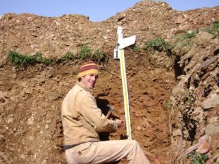
A soil profile analysis describes the nature and extent of the soil horizons. A soil horizon is a layer of soil which is different from adjacent layers. By describing the relations between horizons, and delineating boundary layers — as well as the nature of waterflow — the grower can better elucidate root penetration and restrictive layers.
Vine nutrient status: Soil-to-Fruit
We offer the following analyses:
- Leaf petiole analysis
- Berry sampling
- Wine analysis
Hydrogeology
The concept of water storage in soils is the heart of hydrogeology. Values such as bulk density, hydraulic conductivity, root depth, acreage, and canopy size can be used to determine porosity in order to model intrinsic permeability (the propensity of a soil to transmit fluid under a hydraulic gradient). This value — along with the soil water’s temperature, viscocity, and density — will give us a model to infer the hydrogeologic water flux which is a component of: specific discharge, seepage velocity, specific yield, and specific retention. Using this data to calculate a site’s specific storage and applied to the depth of horizons will give us the site’s storativity.